|
|

|
AD: ArcaOS 5.1 Russian LIP
Russian ARCAOS exists and it's available since the middle of 2017.
All versions are supported: 5.1, 5.1.1.
eCo Software is able to maintain OS/2 LIP packages for any other language
(German, Dutch, Brazilian Portuguese, Spanish, Sweden, etc)
|
eComStation Conquers the Altai Mountains |
TITLE: eComStation Conquers the Altai Mountains
DATE: 2003-11-19 02:00:06
AUTHOR: Yuriy Vishnevsky
Please use online translator
go to http://translate.google.com
and request the translation of http://en.ecomstation./showarticle.php?id=97
to your language |
This is from the diary of climber..
As
reported earlier,
accompanied by brave and stalwart companions, I went to the Altai Mountains
to hike along a trail of special natural beauty under the flag of eComStation.
The plan was to unfurl the eComStation flag at the most beautiful and difficult
sites to honor the birthday of the
eComStation.Ru web site.
  Altai - 2003,
  Chuyka Ridge,
  60 kilometers to the Mongolia,
  Ak-rub Gorge.
August 1, 2003.
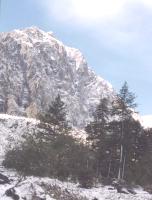
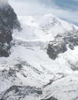
Find us at the Ak-rub Gorge, next to the Cliff of "Karatash" (photo 1, photo 2).
|
|
|
| Photo 1: Facade of "Karatash" in the Ak-rub Gorge.
|
|
Photo 2: A glacier by Ak-rub - "Karatash Mountain".
|
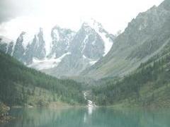
We begin our trip to the Shavlinskoye Lakes which are located by three mountains, Fairy Tale, Dream, and Beautiful Mountain (photo 3). We were lucky. The weather did not give us trouble. Snow already covers the normally green slopes of the mountains. The task at hand is to reach the mountain peak, to plant the eComStation flag there, then go down the other side of the mountain to the Dzhelo Valley. And this is exactly what we did!
On the ascent, though, some members fo the party began to suffer from hypothermia and lack of oxygen, so we had to distribute their load to the the ones still feeling sufficiently strong.
|
|
|
| Photo 3: The upper Shavlinskoye lake is located under the mountains "dream", "fairy tale" and "beauty". |
|
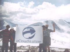
Photo 4: Unfurling the eComStation Flag on the mountaintop.
|
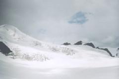
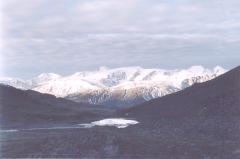
Ten hours underway and we reach the summit! (Photo 4). The snowy summit of the mountain, with adjacent mountains becoming visible (Photo 5). It gets dark quickly so we need to get down to the Dzhelo Valley as quickly as possible, but it is still several exhausting hours. (Photo 6).
|
|
|
| Photo 5: The snowy summit of the mountain.
|
|
Photo 6: The lake and Dzhelo Valley with the imposing mountains beyond.
|
August 6, 2003.
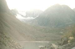
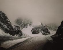
This was the most difficult day for us. We had to traverse and cross the dangerous Abyl-Oyuk (Photo 7). This is an area well known for the consistently poor weather climbers encounter, contributing to a dangerous passage. Actually, as soon as we reached the first glacier, high winds carrying snow mixed with rain assaulted us. Along the second glacier I was forced to use my ice axe to create steps for those following me.
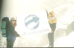
When we reached the top, we again unfurled our eComStation flag (Photo 8). The conditions were so severe that our video camera would no longer work, and we were limited to our regular camera for this picture.
|
|
|
| Photo 7: Crossing Abyl-Oyuk from Abyl-Oyuk Lake.
|
|
Photo 8: eComStation unfurled at the summit of Abyl-Oyuk.
|
From there it went from bad to worse. It is extremely dangerous to go down the face of the glacier in this weather; snow, rain, and winds. In fact, some of our company looked at the complex descent and decided against it. It was a long and difficult descent, about 1,500 meters with an average descent angle of 80 degrees.
It fell to some of us to use a little psychology, but we finally got the group down. I photographed this excellent crossing. Unfortunately, much is hidden by clouds, but Photo 9 shows how hostile this terrain is.
 |
 |
 |
| Photo 9: Crossing Abyl-Oyuk from the Shavlinskoye Lakes.
|
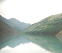
Photo 10: The Lower Shavlinskoye Lake. |
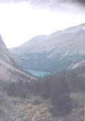
Photo 11: The Lower Shavlinskoye Lake from a distance, and from the same elevation as the upper lake. |
In Photos 10 and 11 you see our goal, the Lower Shavlinskoye Lake. It took two more days to reach it. And then there was still the prospect of the return route. But that is best kept for another story.
(c) 2003, Yuriy Vishnevsky.
Komentarze: Yuran 
2003-11-19 08:58:31 | Wow! Thanks for translation! ;) | Wolfi 
2003-11-28 10:33:17 | Thanks for sharing this experience with us and translating the story into english.
Must have been quite an adventure.
In which altitude range are those summits you climbed up to and in which are the upper and lower Шавлинским lakes?
Is the Алтай located somewhere in the wider area of Ulan-Ude? | Wolfi 
2003-11-28 10:39:23 | Well, using the cycrillic names from the russian article apparently didn't work well here.
The name in the first question was: Shavlinskoye
and in the second one: Altai | Yuran 
2003-12-01 20:01:24 | Mountain "Kupol" - about 4000 m.
Abyl-Oyuk pass - 3200 m.
Upper Shavlinskoye - 2200 m.
Lower Shavlinskoye - 2000 m. | Yuran 
2003-12-01 20:08:06 | Ulan-Ude is far enough from Altai | Tom Lee Mullins 
2003-12-18 20:14:15 | The translation is truly appreciated. The photos are awesome. Thanks. | Dr.Maga Guyman 
2004-10-24 18:10:29 | A very nice site keep it up |
Komentarz artyku³u.

|
If eComStation PC doesn't work properly (USB troubles / network is slow / can't run with 2 CPUs / applications crash) then make some efforts, analyze the problems and setup the system. eCSFAQ Frequently asked questions and answers |
|
|
 |

IBM OS/2 Warp
|


